A steady rise in water levels and weather forecast for the coming weeks have put Nigeria at risk of witnessing a recurrence of catastrophic flooding similar to what it witnessed in 2012, the Nigeria Hydrological Services Agency (NIHSA) has warned.
In a statement by its Director of Engineering, Clement Nze, on Thursday, NIHSA said the signs observed before the massive 2012 flood in several states have manifested.
“There has been systematic daily rise in the water levels on both rivers. Records from our measuring stations in Lokoja (River Niger) & Makurdi (River Benue) clearly show this,” the agency said.
“This situation calls for watchfulness on the part of the riparian states as there is still likelihood of occurrence of river flooding. Shiroro Dam has already joined Kainji and Jebba Dams in spilling water. This has contributed to the steady rise in the water level.”
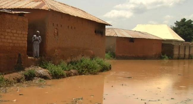
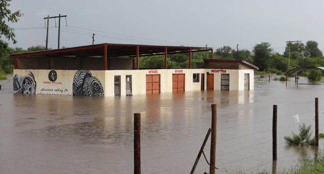
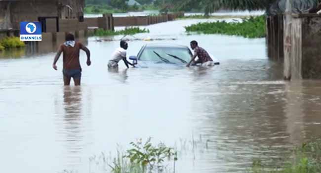
In 2012, catastrophic flooding had affected up to 30 states in Nigeria and resulted in the deaths of over 300 people and displaced more than two million people, according to data from the National Emergency Management Agency.
NIHSA believes the country is at risk of a recurrence of the disaster if steps are not taken.
“As at today, 06-09-2018, our hydrological measuring station downstream the confluence in Lokoja recorded a stage height of 9.89m and a discharge value of 21,326 cubic metres/second as against lower values of 9.43m and 19,762 cubic metres/second recorded on the corresponding date of 06-09-2012,” the agency said.
“From the foregoing, it could be said that all the indices that caused the 2012 river flooding have manifested, except spillage of water from the Lagdo Dam.”
This comes exactly one week after the agency issued a flood alert for seven states – Kebbi, Niger, Kwara, Kogi, Anambra, Delta, and Bayelsa – on the floodplains of River Niger.
In Thursday’s update, NIHSA said the latest development called for watchfulness by states along the floodplains of not just River Niger but those of River Benue as well.
It, therefore, called on 12 states to be on alert with Edo, Taraba, Benue, Adamawa, and Rivers states joining the seven states previously put on alert.
Explaining its latest data as it relates to indices from 2012, NIHSA said, “For the records, it was on 29-09-2012 that the maximum flood level of 12.840m and the corresponding discharge of 31,692 cubic metres/second were recorded at our station in Lokoja, downstream the confluence in 2012.
“By (Nigerian Meteorological Agency) NiMet’s 2018 Seasonal Rainfall Prediction (SRP) released earlier in the year, 28th September is the earliest cessation date of rainfall in Sokoto and Katsina, while December is the earliest cessation date for the southern coastal cities.
“The implication of this is that the Northern part of the country should be expecting more rains in the next three weeks. High flows are still being expected from the upper catchment of the Niger Basin. The River Benue is equally rising, though the level of water as at today has not attained the level witnessed at this time in 2012.”
According to the agency, the localised urban flooding incidents being witnessed in some cities and communities in the country are expected to continue due to high rainfall intensity of shorter duration, rainstorms, blockage of drainage system and poor urban planning, as well as coastal flooding resulting from sea rise and storm surges.
While it promised to continue to update Nigerians on new developments, it urged riparian states to take steps to check flooding.
“States and local governments should endeavour to remove structures built within the floodplains, clear blocked drainages, culverts, and other waterways,” it said.